Corsica’s Tra Mare E Monti (trip)

Corsica’s Tra Mare E Monti
- Ajaccio Airport, France
- Active & Adventure
| from $3,095* per person | 12 Days | September |
| Comfort accommodations | Exertion level: 3 | |
| Operator: Distant Journeys | 12 people max | |
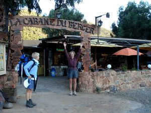
The Tra Mare e Monti, “between the mountains and the sea,” winds its way along the northwest coast of Corsica alternately wandering between secluded mountain hinterlands and stunning coastal seascapes. Beginning and ending in the port cities of Ajaccio and Calvi, this 12-day journey will take us through the Scandola nature reserve with its incredibly red cliffs, beneath the curiously serrated peaks of Paglia Orba and Cinq Frati, and to the tiny fishing village of Galeria accessible only by foot or boat. Ancient mule paths, time-worn Genoese footbridges, sleepy hamlets with simple “gites” offering classic Corsican cuisine are all beckoning reminders a long tradition of traveling by foot.
Loading map, please wait...
Locations visited/nearby
France, Europe
Itinerary
Day 1: Rendezvous at the Ajaccio Airport. Group transfer to Cargese, about one hour away. Cargese is a peaceful little village perched on headland and surrounded by a deep-blue sea. A starting point for both long-distance walks, the Tra Mare e Monti and Mare a Mare Nord, its small lanes sprinkled with bougainvillea, fig trees and palms exude a welcoming and relaxed atmosphere. Welcome dinner and trip orientation.Day 2: Today’s hike will be a day hike to the dramatic Punta Orchinu and the Punta Omigna, both jutting dramatically into the Mediterranean Sea. Both these puntas define the rugged western coastline of Corsica. In the afternoon, we return to Cargese.
Day 3: Today’s hike is one of the most remote and wild of any on this route. After an early transfer to our trail on Revinda, our route turns northeast and meanders gently up the Sulleoni Valley though old-growth marquis scrub below the ragged peaks of Punta di Scavata. We pass an old circle of stone once used for storing and drying chestnuts and further on we encounter the remains of an old copper mine. From the mines, we begin our first real climb of the day up the narrow Riogna Valley.
Arriving at the pass of Bocca d’Acquaviva (1102m, 3,637’) our route becomes more undulating and wilder until reaching the ridge top of Culletta au Prunu (969m, 3,200’) marked by a cairn and crucifix. From here expansive views to the distant Golfe de Sagone accompany us as we follow an old mule path over the Bocca a u Mamucciu (824m, 2,720’) and through stately chestnut groves before we end our day in the little village of Marignana (715m, 2,360’).
Day 4: The first hour and a half of today’s hike takes us alternately through marquis and chestnut forests to the deserted settlement of Tassu and then onto the more thriving village of Evisa. The crossroads of the Tra Mare e Monti and the Mare e Mare Nord, Evisa is a magnet for “through” hikers as well as day hikers.
From Evisa, our route takes us down the spectacular Spelunca Gorge along an old cobbled mule path. Leaving the shade of chestnut trees, we descend through oak and pine forest to the confluence of the Aitone and Tavuella rivers. We cross the Genoan arched bridge of Pont de Zaglia, following the deep ravine of Spelunca Gorge. From the gorge, our route takes us along the Lonca River, where we’ll pass a series of wonderful natural pools that provide the perfect opportunity for an afternoon dip. After crossing Pont Vecchiu, our second Genoan bridge of the day, we climb to the village of Ota and our gite for the night.
Day 5: Today’s hike takes us up through the orange-colored Vitrone Ravine, and on to the hidden plateau known to locals as Pedua. We’ll have impressive views of Calanches de Piana and Cappa Russu in the distance before descending to the pass Capu San Petru (914m, 3,016’). A steady descent gives us occasional views of the dramatic peak of Paglia Orba before ending in the little settlement of Serriera (50m, 165’).
Day 6: This is a relatively short day. From Serriera, we climb the shoulder of Capu d’ Ocra reaching an elevation of (350m, 1,155’). Our route turns east and descends to cross the stream of Vetricella (66m, 218’). Climbing again, our trail emerges just above the village of Partinello with views out to the Golfe de Porto. Skirting behind the hilltop of San Angelu, we traverse below the cliffs of Capu a Parate before descending into Curzu (250m, 825’).
Day 7: Some consider this hike to be the most stunning stage of the route. You can decide. Leaving Curzu, the trail climbs to just below Capu di Curzu 2,812’. From here, we descend to Bocca Croce and to the isolated beach of Tuara. After a wonderful stop for a swim in the clear blue waters, we hike the last hour or so to the quaint village of Girolata with its red tile roofs and narrow alleys. Girolata has been designated as a World Heritage site, which is a part of UNESCO, and is accessible only by foot or boat. This overnight stop is memorable.
Day 8: Leaving Girolata, we begin a pleasant climb up the Cavone Ravine toward the summit of Capu Licchia. At the saddle of Bocca di Fuata (458m, 1,511’) the trail turns east following to Punta di a Liternicco. Again, we will have amazing views of the wild landscape of the interior from Scandola to Paglia Orba, as well as the red rocky coast bordering azure blue bays. Turning north, we descend the Tavulaghiu valley to our next seaside village of Galeria (25m, 83’).
Day 9: After a leisurely morning in Galeria, we head inland to follow the Vallee du Fango and the river of the same name. Climbing steeply at first, we will soon have views north to the coastline and beaches. With fine views of the Paglia Orba massif, also called Le Grande Barriere, we cross the old stone bridge of Ponte Vecchiu (46m, 151’) and meander along the river until we reach our gite for the night at Tuarelli (90m, 297’). Deep, natural pools along this last stretch of trail provide an inviting opportunity for an afternoon swim.
Day 10: We cross two passes today, Bocca di Lucca (589m, 1.944’) and Bocca de Bonassa (1,153m, 3,805’). From Bocca Bonnassa, we’ll have our first glimpse of the Golfe di Calvi to the north and to the east the granite spires of the Cirque de Bonitfatu. Our route today will be accented by giant holm oaks and maritime pines, as well as the prospect of spotting one of the golden eagles that nest in this area. Our last night on the trail will be spent at the gite in Bonitfatu.
Day 11: Our final stretch of the route is relatively short, taking us up through the Foret de Sambucu and down to the village of Calenzana, the terminus of the Tra Mare e Monti. This stage is more obligatory than beautiful as much of the Foret de Sambucu was damaged by fire several years ago. Descending, after our final pass, Bocca u Corsu at 599m, we arrive in the pretty village of Calenzana.
The largest village in this region of Balagne, Calenzana is a maze of small lanes and old granite houses surrounding the church of Saint Balise with its Baroque belfry. Allowing time to poke around or celebrate at a near by cafe, we then transfer to the port village of Calvi and our hotel.
Rumored to be the birthplace of Christopher Columbus, Calvi is a picturesque seaside town with striking bulwark of a citadel jutting out to form a turquoise blue bay. Farewell Dinner.
Day 12: Depart Calvi. The airport is about a 25-minute taxi trip from the hotel.
More information from Distant Journeys:
- View trip on provider's website
www.distantjourneys.com/destinations/france/corsica/… - Company profile, experience, and history
- View all of their trips
- Email this trip page to a friend
-

Comments from Facebook