Cape Town To Nairobi (trip)

Cape Town To Nairobi
- Cape Town International Airport, Cape Town, Western Cape, South Africa
- Active & Adventure
| from $4,299* per person | 40 Days | May-December |
| Comfort accommodations | Exertion level: 3 | |
| Operator: G Adventures | 12 people max | |
Loading map, please wait...
Locations visited/nearby
Kenya, Tanzania, Africa
Itinerary
Day 1 Arrive Cape TownArrive in Cape Town and make your way to the hotel. Attend a pre-departure group meeting with your tour leader scheduled for the evening.
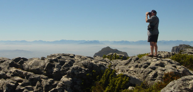
Cape Town offers many different activities – something for everyone. Visit Robben Island, Table Mountain, explore Cape Point (Cape of Good Hope), embark on a wine tour in and around Stellenbosch (45min drive). Visit the old French Hugonote town of Franschoek and surroundings (1h drive). For the not so faint hearted there is numerous adrenaline activities in the surrounding areas, from skydiving to abseiling to cage diving and having a close encounter with the great white sharks. Or wonder through the city centre with some of the oldest buildings and gardens in South Africa (Botanical Gardens and Parliament Gardens). Do not miss the wonderful Cultural Historical Museum, Planetarium and numerous other small museums and theatres.
Cape Town's name originated from the term 'Cape of Good Hope' when Bartholomew Diaz and other seafarers looked forward to the sight of Table Mountain, like an inn that promised hospitality and prosperity. The city is steeped in a rich history and is a cultural melting pot with its diverse and vibrant character being derived from Khoxisan and other African tribes from the North, and Indonesian, French, Dutch, British and German settlers. Cape Town is the third most populous city in South Africa, with over 3 million inhabitants, and is the provincial capital of the Western Cape. It is also the legislative capital of South Africa, where the National Parliament and many government offices are located.
For shopping, dining and entertainment the V&A Waterfront is a hotspot for foreigners and locals alike. Still a working harbour, the Waterfront is an example of creative architecture and restoration and has become South Africa's most visited tourist attraction. The Waterfront offers over 250 shops from designer boutiques to craft stalls, a host of restaurants and coffee shops and plenty of other activities.
For cultural exchange, you shouldn’t miss out a "Local Dinner” in a private home in an informal settlement. This authentic community experience provides guests the opportunity to get deep inside the heart of Cape Town. Choose from Cape Malay, Xhosa traditional or Cape Town fusion foods, and visit families in their private homes in townships and get insight into South African realities - be part of the family for an unforgettable night. Proceeds go into the community.
Visit Red-Hill pre-school, one of our Planeterra project. Planeterra - the G Adventures Foundation is our non-profit organization that was developed to give back to the people and places we visit on our tours. Planeterra supports local community projects, non-profit organizations and international charities that focus on the areas of health, education, community development, environmental conservation and employment skills training.
Day 2 Gariep River (B,L,D)
Approximate Distance: 567 km
Estimated Travel Time: 11 hrs
Today we head north to the South Africa/Namibia border stopping on the South Africa side of the Gariep River. After setting up camp, enjoy a late afternoon swimming, relaxing, or possibly even canoeing on the river.
The Orange River, in the past also sometimes known as the Gariep or as the Grootrivier, is the major river of South Africa. The river was first discovered by indigenous people but only explored by Europeans in 1760 and named after the House of Orange, which was the Stadhouder of Holland between 1777 and 1779. Another account of its naming suggests that it may have been called after the supposedly orangey colour of its water, as opposed to the colour of the water of the Vaal River (‘vaal’ being Afrikaans for pale or grey). The farthest head stream of the Orange rises in the Drakensberg Mountains along the border between South Africa and Lesotho, about 193 km (120 mi) from the Indian Ocean and at an altitude of over 3000m. While in Lesotho, the river is known as the Senqu and parts of it freeze in winter, owing to the altitude there. It then runs 2200 km (1367 mi) westwards and eventually discharges into the Atlantic Ocean at Alexander Bay, forming the border of Namibia and South Africa.
Orange River, in sections, is a good diamond mining area. For thousands of years silt has washed down the river and produced diamonds on its banks. These diamonds also reach the sea and with long-shore currents (going northwards) and wind and wave action, they have been known to wash up on the shorelines.
Day 3 Fish River Canyon (B,L,D)
Approximate Distance: 180 km
Estimated Travel Time: 5 hrs (with border crossing)
Today we will cross the border from South Africa to Namibia. The name of the border post is Vioolsdrift on the South African side and Noordoewer on the Namibian.
We have been experiencing a lot of problems with people that need visas for Namibia. Namibian visas is not available at the border, so please make very sure if you do need a visa before arrival. See our visa section for further information. Remember that visas are your own responsibility, so please double check with your agent if you will require a visa for Namibia.
The South African Rand (ZAR) and the Namibian Dollar (N$) has the same value, so you can use ZAR in Namibia. You will only be able to change any other foreign currency into N$ in Swakopmund. However, when you pay in ZAR your change will be in N$.
We will make our way to Fish River Canyon, the largest canyon in Africa and arguably the second largest in the world. We spend some time at the canyon, and in the early evening, watch as a spectacular sunset slips over the canyon's rim. Camp the night in the surrounding area.
At 650 kilometres in length, the Fish River is Namibia’s longest river. Its source lies in the eastern Naukluft Mountains and flows south-west of Ai-Ais into the Oranje.
The canyon itself is situated along the lower reaches of the Fish River, and is one of the most impressive natural formations of southern African. It is approx 161 km long, 27km wide at its widest point and 550m deep. It is the oldest canyon in the world, formed approximately 500 million years ago, with some rocks at the bottom dating up to 2600 million years old. The canyon was formed in part by glacial movements (upper section), movement of tectonic plates, and erosion. Four wet periods, or pluvial periods, have occurred in the south-western part of Africa during the last million years, resulting in a large run-off of water, which sped erosion.
The plateaus are 220m from the base of the canyon. Catfish can be found in the Fish River below, and they are known to survive the dry season by burrowing into the mud until the water returns. It’s a very slow moving and shallow river – more like a stream. Water levels are normally highest during February until April. The highest recorded temperature at the bottom of the canyon was 58 C.
Day 4-5 Namib Desert (2B,2L,2D)
Day 4 Approximate Distance: 560km
Estimated Travel Time: 10 hrs
Day 5 Approximate Distance:95km (excl drive to dune 45 and Sossuvlei)
Estimated Travel Time: 3 hours (excl morning drive to dune 45 and Sossuvlei)
Continuing north along long, poor quality roads, we will pass the small and desolate towns of Bethanien and Helmeringhausen en route to the Namib Desert. Arrive in the area in the late afternoon, where the towering red sand dunes of Sossusvlei form the gateway into the Namib Desert. Here you will really feel as though you’re in the middle of nowhere.
The following day is spent exploring this the natural wonders of this bizarre environment. You will visit Sossusvlei - a clay pan, enclosed by the world’s largest sand dunes, up to 300m high. Here you can take a guided walk at the sands dunes, and enjoy some free time to enjoy them on your own. Climb the mighty Dune 45 and reach the top just before the sunrise (we will get up around 5am on the morning of day 5). As the dunes start to be covered by dark blue shadows it is just a big, - silent - 'wow', leaving you speechless. Also, make a stop at Sesriem Canyon, a small canyon typical of the area, and invisible from even a short distance away. After all this we drive a bit further to to our campsite where we will be staying on day 5.
The name Namib is of Nama origin, with the modern spelling referring to a desert, but a particular part of the desert, specifically a large plain. The desert is classified as either extremely arid or hyper-arid, with a mean rainfall or less than 100mm of rain per year.
The dune sands are primarily derived from sediments washed down the Orange River and then moved northwards by the long shore drift plus the dominant southerly quadrant winds. The winds move the sand northwards and inland, trapping it by wave action in coastal embayment.
The types of dunes found is Star dunes, formed as a result of wind coming equally strong from all directions; Barchan dunes, crescent shaped and formed where wind is mainly from one direction and with a shortage of sand and the Linear dunes, which are long dunes with sharp crests that tend to lie in parallel rows. They are a result of two dominant winds in the central Namib- Southerly and easterly winds. Linear dunes form in a south to north direction.
The 14km long Sesriem Canyon was formed by the Tsauchab River rising in the Naukluft and Zaris Mountains to the east, and flowing through to Sossusvlei. Walking through the canyon takes you on a journey back 10-20 million years ago when sedimentary layers of gravel and sand were deposited and cemented together by lime. The ledges are now inhabited by pigeons, raucous pied crows and chattering starlings. But look a little higher and you might see a lanner falcon or the soaring spread of a lappet faced vulture with a wingspan of 2.6m. An amazing variety of wildlife has adapted to live in this inhospitable place such as lizards that only put 2 feet down at a time and the black toc tokkie beetle who leans forward to allow droplets of morning mist run down its body into its mouth.
Close inspection of the canyon brings you to the brink of a sharp drop but there is an easily accessible path which takes you down into its depths. You can even have a dip it its murky pools amongst little fish, if the water is high enough.
The Tsauchab River was an important source of water for early inhabitants and even during dry times there is water in the upper reaches, where deep clefts in the rock reduce evaporation. Explorers, transport riders, and early travellers used to lower a bucket down to collect the water and it normally took 6 lengths of thong tied together, hence the Afrikaans name “Ses” meaning six, and “Riem” meaning thong.
Day 6-7 Swakopmund (B,L)
Approximate Distance: 300km
Estimated Travel Time: 7 hrs
Today you will really get a feeling for the Namib Desert, as you spend hours crossing this void region, and crossing a few dry mountain passes. Before arriving to Swakopmund, you will drive past Walvis Bay, the only town on the Namibian coastline that hosts a deep-sea harbour. We will spend 2 nights in the area, here you can explore this historical town or try some of the numerous activities available, such as dune boarding and a dolphin cruise.
Note: If you pre booked the Namibia Adrenaline theme pack you will be able to do your activities on day 7.
Swakopmund has mind-boggling lunar landscapes, unforgettable sunsets, and bizarre prehistoric Welwitchia plants. The Topnaar people who live in the valley of the Swakop River derived the name from the mud, flotsam, and general detritus washed down during its infrequent floods, which reminded them of very loose evacuation of the bowels.
Almost a full four centuries later, the area, then known as South West Africa, was under Germany control. In choosing a location for a port, German captain Curt von Francois chose this site, north of Walvis Bay (an already existing English-controlled port), at the mouth of the Swakop River, for creating an artificial harbour. A military fort was built here in 1892, which was the beginning of Swakopmund. The building of the railway began in 1895. After the First World War, Germany lost occupation and the port/harbour was automatically displaced by Walvis Bay.
Namibia is well known for its desolate northern coastline called the Skeleton Coast. Along the West coast of Namibia flows the Cold Benguela Current. Also along the coastline is a very hot desert. What happens is that the cold, moist air from the sea mixes with the warm air from the desert and forms a very heavy mist. This mist over hundreds of years has caused many shipwrecks along the coast and if the sailors survived they soon perished in the unforgiving desert. It is from this, and from all the wrecks and shells of stranded ships along the coast, that the region received its name. As you approach the coastline you will see the band of mist.
In 1486 Portuguese Diego Cáo landed just north of what is now Swakopmund and erected a stone cross in honour of John II of Portugal. Known nowadays, as Cape Cross, the area is commonly visited by tourists looking for the large population of Cape Fur Seals that inhabit the coast.
NOTE ON ACCOMMODATION: In Swakopmund, we stay in backpacker's (hostels) or small guest houses, which will give us a break from camping and to be better located than the campgrounds in the area. Here, the accommodation is based on several people sharing dormitory-style rooms, with possibly 6 to 8 people sharing a room. Although we will try, we cannot guarantee to be able to divide the group into different dormitories based on gender lines. As such, males and females may have to share the same sleeping quarters for these nights. The bathrooms and showers are private, but may also be shared between both males and females
Day 8 Damaraland (B,L,D)
Approximate Distance: 200 km
Estimated Travel Time: 7 hrs
Look out over the beautiful desert landscapes as far as the eye can see. Begin moving north into the stony desert landscapes and set up camp near Twyfelfontein. In the afternoon explore the area, which is adorned with rock engravings and petrified fossil forests.
About 100,000 Damara people live in Namibia, they share a common language with the Nama but have no kinship. The Damara have mystified anthropologists as they are a group of Bantu origin who speak a Khoisan dialect. Due to their resemblance to some Bantu groups of West Africa it is speculated that the Damara were the first people to migrate to Namibia from the north. There is evidence that the Damara have kept small herds of stock for centuries, they also grow tobacco and pumpkins, and in more recent time they have begun cultivating vegetables and corn. Prior to 1870 the Damara occupied most of central Namibia, but large numbers were displaced or killed when the Nama and Herero began to occupy this area in search of better grazing. When the first Europeans visited Namibia the Damara were a group of semi-nomadic gardeners, pastoralists and hunter-gatherers. They also had skills in mining and metal work. However in 1960 the South African government settled the Damara people in the area of Twyfelfontein and Khorixas, now known as Damaraland. The area has poor soil and irregular rain fall, and as such this has changed the way of life of the Damara and many now work in urban areas, with only about one quarter of their numbers actually residing in Damaraland.
This area is a famous for the bushmen paintings found in the region. The valley is known in the Damara language as Uis (fountain). This natural spring (when is flowed) attracted game animals and man. But the consistency of water flow has always been erratic, thus the Europeans named it Twyfelfontein (Doubtful fountain).There are numerous well-preserved rock engravings here. Their origin is uncertain, but they are probably the work of Bushmen or Nama artists and are estimated to have lived in the area 5,000 years ago.
Day 9-10 Etosha National Park (2B,2L,2D)
Approximate Distance: 300km
Estimated Travel Time: 8 hrs (including game drive to camp)
Etosha in waMbo means "the great white place of dry water" or “white place of mirages” . As one of Africa’s highlights, the Etosha National Park offers a variety of wildlife and phenomenal natural beauty.
Upon arrival in the area in the afternoon, we continue on a game drive around the huge dry pan to find the elephants, herds of antelope and lions around the waterholes. After sunset you can watch some animals at the watering holes near the camping area, which is safe, being well lit with flood lights. Game drives are done in our overland vehicle. Night game drives are done by Namibia Wildlife Resorts in open vehicles (optional, at extra cost). The following day, enjoy another game drive en route as we travel towards the eastern side of Etosha.
A brief animal count of Etosha National Park: 30 000 Blue Wildebeest; 25000 Springbok; 23000 Zebra; 5000 Kudu; 3000 Hartebeest; 3000 Gemsbok; 2600 Eland; 450 Giraffe; 2000 Elephant; 260 Lions; 20 Black Rhino; 325 Bird species.
Etosha National Park in Namibia was first established in 1907, when Namibia was a German colony known as South West Africa. At the time, the park’s original 100,000 sq km made it the largest game reserve in the world. Due to political changes since its original establishment, the park is somewhat less than a quarter of its original size, at 22,912 sq km, but still remains a very large and significant area in which wildlife is protected.
The Etosha Pan dominates the park. The salt pan desert is roughly 130 km long and in places as wide as 50 km. The salt pan is usually dry, but fills with water briefly in the summer months, when it attracts pelicans and flamingos in particular. Periannual springs attract a variety of game and birds throughout the year, including the endangered Black Rhinoceros and the endemic Black Face Impala.
The name Okaukuejo (our first night’s camp) is derived from oKakwiyo, meaning “place of the fertile women”. It began as a veterinary post created by the Germans during a rinderpest epidemic in 1897. In 1901 a small fort was built here as a military stronghold. Namutoni, our camp for the second night in the park, was named after a spring found in the area. The waMbo called the spring oMutjamatund (high landmark). The name got distorted through the years. In 1903 a small fort was built at Namutoni, and it was maintained as a police outpost and customs post by the Germans.
Day 11 Waterberg Plateau Game Park (B,L,D)
Approximate Distance: 381 km
Estimated Travel Time: 5 hrs (excluding game drive out of Etosha)
Enjoy one last morning game drive in search of the Etosha's incredible wildlife, and begin moving south to Waterberg Plateau Game Park, where in the afternoon you can take a scenic forest walk to enjoy the natural beauty of the area.
For those who are up for it, can get their hiking shoes on to do the hike up to the Waterberg plato with its magnificent view over the plains of Namibia.
Day 12 Windhoek (B)
Approximate Distance: 280km
Estimated Travel Time: 5 hrs
Please note that as this is a COMBO tour some of you fellow travellers might end their journey in Windhoek but you might also get new travellers joining the tour.
Leave Waterberg Plateau Game Park and head south through the Namibian countryside to Windhoek. With a population of 230,000, and an altitude of 1654m, Windhoek is the capital of Namibia.
Windhoek was originally the centre of a Nama chief who defeated the Herero inhabitants of the region in the mid 19th century. Germany then occupied the region in 1885, where they renamed the original site Windhoek. They built a fort here that eventually spanned a town that grew under its protection.
Windhoek became the seat of colonial rule in 1892, as the capital of the colony of South-West Africa (Deutsch-Südwestafrika). During World War I, Windhoek was captured by South African troops and became a British dominion. Until the independence of Namibia was inaugurated in 1990, Windhoek was recognized as the capital of South West Africa as administered by the South African government.
The city of Windhoek is traditionally known by two names: Ai-Gams, from the Nama people, which literally refers to the hot springs that were once part of Windhoek, while the second name, Otjomuise, meaning a place of steam, was given by the Herero people. Both traditional names reference the hot springs.
Day 13 Kalahari (B,L,D)
Approximate Distance: 500 km
Estimated Travel Time: 9 hrs
Today we will cross the border from Namibia to Botswana. The name of the border posts are Transkalahari border post on the Namibian side and Mamono post on the Botswana side.
Botswana visas is not available at the border, so please make very sure if you do need a visa before arrival. See our visa section for further information. Remember that visas are your own responsibility; please double check with your agent if you will require a visa for Botswana.
The currency in Botswana is Botswana Pula (BWP.)You will be able to change your let over ZAR and N$ or other foreign currency tomorrow in Maun. Your campsite tonight will take USD or ZAR.
Today we continue through the eastern part of Namibia, and cross into Botswana and travel into the heart of the Kalahari. Take the opportunity to walk with a local San Bushmen to learn fascinating bush skills (local guide may not be San due to nomadic lifestyle of San Bushmen).
Ghanzi, located western part of Botswana on the northern rim of the Kalahari Desert, is the administrative center of Ghanzi District, and is also known as the "Capital of the Kalahari". Ghanzi is an intriguing town, and is primarily a farming community that supplies the Botswana Meat Commission with most of the required beef produce. In fact, it is the starting point of a 800 km long cattle trek—one of the longest in the world. Cattle are driven on horseback or by truck across the Kalahari southeastward to slaughterhouses at Lobatse.
Ghanzi mostly consists of a variety of ethnic cultures for instance the Bushman, Bakgalagadi, Baherero, Batawana as well as Afrikaners. Other spellings include "Gantsi," which is more consistent with the national language of Botswana, Setswana, "Ghansi," and "Gantsi.
Day 14 Maun (B,L,D)
Approximate Distance: 350 km
Estimated Travel Time: 7 hrs
As you travel from the Kalahari towards Maun, you will notice the landscape change slightly, as you approach more fertile lands. After arrival, you can pick up any supplies and prepare for you 2 night/3 day excursion into the Okavango Delta.
Note: If you pre booked the Okavango by plane theme pack, you will be flying today.
Maun is the gateway to the Okavango Delta and has for a long time enjoying the reputation of being Botswana’s own frontier town. Today it is one of the fastest growing towns in Africa. It was originally established in 1915 by the Batawana, a splinter group of the Bangwato. The name Maun means “place of reeds”.
Maun, although officially still a village, is the fifth largest town in Botswana. It is an eclectic mix of modern buildings and native huts. Maun is the "tourism capital" of Botswana and the administrative centre of Ngamiland district. Maun has developed rapidly from a rural frontier town and has spread along the Thamalakane River. It now boasts good shopping centres, hotels and lodges as well as car and 4-wheel drive vehicle hire. It still retains a rural atmosphere and local tribesmen continue to bring their cattle to Maun to sell. This community is now distributed along the wide banks of the Thamalakane River where red lechwe can still be seen grazing next to local donkeys, goats and cattle.
Day 15-16 Okavango Delta (2B,2L,2D)
Accommodation: Basic bush camping
After leaving some of our luggage in Maun, we begin our fantastic 3 day/2 night excursion into the delta as we drive about 1-2 hours (depending on which dock we go to) to the "dock" where we hop into a mokoro, a traditional dug-out canoe, that'll take us deep into the delta. After a couple hours in mokoro, we arrive to our basic “bush camp”. For 2 full days, enjoy game walks, mokoros (occasionally unavailable due to seasonality), birdlife and game viewing in the pristine wilderness area of the Okavango Delta, the world's largest inland delta.
"Where all this water goes is a mystery", Aurel Schultz, 1897
The area of the delta was once part of Lake Makgadikgadi, an ancient lake that dried up some 10,000 years ago. Today, the Okavango River has no outlet to the sea. Instead, it empties onto the sands of the Kalahari Desert, irrigating 15,000 km_ of the desert. Each year some 11 cubic kilometers of water reach the delta. Some of this water reaches further south to create Lake Ngami. The water entering the delta is unusually pure, due to the lack of agriculture and industry along the Okavango River. It passes through the sand aquifers of the numerous delta islands and evaporates/transpirates by leaving enormous quantities of salt behind. This precipitation processes are so strong that the vegetation disappears in the center of the islands and thick salt crusts are formed. The waters of the Okavango Delta are subject to seasonal flooding, which begins about mid-summer in the north and six months later in the south (May/June). The water from the delta is evaporated relatively rapidly by the high temperatures, resulting in a cycle of cresting and dropping water in the south. Islands can disappear completely during the peak flood, then reappear at the end of the season.
Day 17 Gweta (B,L,D)
Approximate Distance: 300 km
Estimated Travel Time: 5 hrs
Enjoy one last sunrise in the delta before travelling back Maun in first Mokkoro, then by vehicle. Pick up your luggage, and proceed on to Gweta to our unique experience camping under ancient Baobab trees.
The town is situated between the larger towns of Nata and Maun and is on the edge of the Makgadikgadi Pans, an immense area devoid of anything but salt and shimmering horizon. As the largest expanse of 'nothingness' on earth, the pans have area the size of Switzerland, and are clearly visible from outer-space. What is known today as the Makgadikgadi Pans is only a relic of what used to be one of the biggest inland lakes Africa has ever seen-Lake Makgadikgadi. The Makgadikgadi pan consists of two main pans, Namely Ntwetwe and Sowa pan, both of which are surrounded by myriad smaller pans. Although it is totally devoid of any water, people used to live there before it was declared state land. Villagers where allowed to graze their livestock inside the boundaries during dry season.
Day 18 Chobe National Park (B,L,D)
Approximate Distance: 300 km
Estimated Travel Time: 7 hrs
Proceed towards Chobe National Park in the morning and camp over just outside of the park near the town of Kasane. This afternoon, take an optional game drive in the park, or an afternoon sunset boat cruise along the Chobe River - your best opportunity to view hippo, crocodiles and watch many elephants wallow in the water.
Kasane is situated on the banks of the Chobe River, near its mouth. This is where the Chobe and Zambezi rivers meet, creating a border area of four countries – Namibia, Botswana, Zambia, and Zimbabwe.
Chobe National Park is Botswana’s first national park, and is situated along the Chobe River. It has one of the largest concentration of wildlife in all the Africa continent and one of the world's last remaining sizeable wilderness area. By size, this is the third largest park (11,000 sq km) of the country, though it is definitely the most diverse and spectacular.
The park is probably best known for its spectacular elephant population: with over 120,000 it has the highest elephant concentration of Africa. Moreover, most of them are probably part of the largest continuous surviving elephant population on Earth. The elephant population seems to have solidly built up since 1990, from the few initial thousands. By chance, they have not been affected by the massive illicit exploitation of the 1970's and 1980's. Elephants living here are Kalahari elephants, the largest in size of all known elephant species. Yet they are characterized by rather brittle ivory and short tusks. Damage caused by the high numbers of elephants is rife in some areas. In fact, concentration is so high throughout Chobe that culls have been considered, but are too controversial and have thus far been rejected. During the dry season, these elephants sojourn in Chobe River and the Linyanti River areas. During the rain season, they make a 200 km migration to the south-east region of the park. Their distribution zone however outreaches the park and spreads to north-western Zimbabwe.
Chobe National Park is also known for its lion population, who on occasion do hunt the elephants. The original inhabitants of this area were the San bushmen (also known as the Basarwa people). They were nomadic hunter-gatherers who were constantly moving from place to place to find food sources, namely fruits, water and wild animals. Nowadays one can find San paintings inside rocky hills of the park.
Day 19-22 Livingstone (4B,L)
Approximate Distance: 120 km
Estimated Travel Time: 4 hrs (depending on ferry crossing)
Please note that as this is a COMBO tour some of your fellow travellers might leave the tour in Victoria Falls but you also might get some new travellers joining the tour.
Today we will cross the border from Botswana to Zambia. The name of the border posts are Kazungula border post on both sides. Some nationalities do require a visa for Zambia. See our visa section for further information. Remember that visas are your own responsibility; please double check with your agent if you will require a visa for Zambia.
The currency in Zambia is Zambian Kwacha(ZWK.)You will be able to change your left over BWP in Livingstone town. Most establishments, activities etc. do accept USD for payment.
Take an optional early morning game drive in Chobe before leaving for Zambia. Cross the Zambezi River to enter into Zambia and continue to Livingstone. We will spend the next three days of our tour here, a great base to see both some natural wonders and take part in some exciting activities. Get up close (and wet from the spray) while awing at the immense Victoria Falls, raft the whitewater of the mighty Zambezi, for the more adventurous, bungee jump with the Victoria Falls in view.
David Livingstone was born on March 19, 1813 in the village of Blantyre, South Lanarkshire, Scotland. He first studied Greek, medicine, and theology at the University of Glasgow and while working in London, joined the London Missionary Society became a minister. He originally planned to gain access to China through his medical knowledge. The Opium Wars, which were raging at this stage with no signs of peace on the horizon, forced Livingstone to consider other options. From 1840 he worked in Bechuanaland (present-day Botswana), and in the period 1852–56, he explored the African interior, and was the first European to see the Mosi-oa-Tunya waterfall (which he renamed Victoria Falls after his monarch, Queen Victoria). Livingstone was one of the first Westerners to make a transcontinental journey across Africa. The purpose of his journey was to open the routes, while accumulating useful information about the African continent. In particular, Livingstone was a proponent of trade and Christian missions to be established in central Africa. His motto, inscribed in the base of the statue to him at Victoria Falls, was “Christianity, Commerce and Civilization.”
The town of Livingstone is a regional transport center, being located near the borders of Botswana and Zimbabwe, and serves as a base for the many visitors to see this part of Africa, and the impressive Victoria Falls, a mere 12km from Livingstone.
The Victoria Falls waterfalls occur in a country that is perfectly flat. From its source on the borders of the Democratic Republic of Congo, the Zambezi River meanders for 1300 km across the wooded plateau of Zambia, eroding for itself a shallow valley on its mild descent to the site of the falls. The river eventually found a weak spot on the lower lip of the surface over which it passed, and forced a passage which was steadily deepened into an exit gorge. During the last half million years the river has scoured out eight of these cracks across its bed. The Victoria falls occurs where the river is 1688 m wide, presents the spectacle of an average maximum of 550 million liters of water a minute tumbling over the lip of the trench in five main falls, the Devil’s Cataract, Main falls, Horseshoe Falls, Rainbow falls and the Eastern Cataract. The highest of these is Rainbow falls, on an average 108 m high. A peak flood sees 750 million liters of water in one minute hurtling over the falls.
The name Zambezi comes from the Tonka tribe, also meaning Great River, but the Sotho-speaking Kololo people of the upper reaches of the river gave it the well-known name of Mosi o a Thunya (smoke that rises). The Lozi people call it by the same name but translated it into smoke that sounds. The Ndebele call it aManza Thunqayo (the water that rises like smoke). The Namibian people call it Chinotimba (a noise-making place like the distant sound of digging).
Day 23 Lusaka (B,L,D)
Approximate Distance: 543km
Estimated Travel Time: 7 hrs
Today’s long journey across rough and bumpy roads takes us to a private game farm 20km's outside of Lusaka, the capital of Zambia. Here you can marvel at the Zebras, Buffalos, and the Boks that roam the property, or relax by the pool or at the rest camp’s bar.
Lusaka, like many African capitals, is a bustling metropolis developing around its colonial roots, its socialist history, and nowadays its drive for independence. It’s an example of how many African cities are trying to find their “independent” way in a world that’s surging ahead. Situated in the southern part of the country, Lusaka is considered one of the fastest growing populations in Africa, and is the governmental and administrative centre of Zambia.
Please note that as today and tomorrow are long driving day we will not have time to pay a visit to the city of Lusaka.
Day 24 Chipata (B,L,D)
Approximate Distance: 544 km
Estimated Travel Time: 10 hrs
Travel north east up through the Zambian country-side, we head to the capital of the Eastern Province, Chipata. Previously known as Fort Jameson, Chipata is a popular refueling station for overlanders heading to South Luangwa National Park.
As today is a long driving day we will not be able to spend time in Chipata town.
Day 25-28 Lake Malawi (4B,4L,4D)
Day 25 - Approximate Distance: 400 km ; Estimated Travel Time: 10 hrs
Day 27 - Approximate Distance: 235 km ; Estimated Travel Time: 5 hrs
Today (day 25) we will cross the border from Zambia to Malawi. The name of the border posts are Mwami border post on the Zambian side and /Mchinji border post on the Malawian side. We have been experiencing a lot of problems with people that need visas for Malawi. Malawian visas is not available at the border, so please make very sure if you do need a visa before arrival. See our visa section for further information. Remember that visas are your own responsibility; please double check with your agent if you will require a visa for Malawi.
The currency in Malawi is Malawian Kwacha (MWK.)You will be able to change money in Lilongwe. Most establishments, activities etc. do accept USD for payment.
Spend four nights relaxing on the shores of “the Lake of Stars”. Beach walks, swimming in the crystal clear water and snorkelling among the tropical fish are all part and parcel of your stay. Visit various lakeside camps as we travel north along the shores of Lake Malawi.
This is Malawi’s main attraction and covers one fifth of the country. It is the third largest lake in Africa and is about 500km long. The lake has more fish species than any other lake in the world with around 600 different species. The largest family is the chichlids, which are exported all over the world to pet shops etc. The lake is also known for its good snorkelling and diving. The locals depend on the lake for fishing and survival and use dug out canoes to fish from and set out long nets. There are many different ethnic groups all speaking their own language, most are Christians and the rest have traditional beliefs as do most African countries
Up in the hills above Chitimba Beach is a mission station named after David Livingstone. Livingstonia is a small mission town that was founded in 1894 by the missionaries from the Free Church of Scotland. At fisrt they planted the mission at Cape Mclear in 1875 but had to move it because of Malaria. They then moved it to the north of Bandawe, but this site was also unhealthy. So they had to move it to the current location between Lake Malawi and the Nyika Plateau. The mission gradually developed into a small town – now having around 6690 inhabitants.
The leading missionary Dr Robert Laws established the best school in this time for the whole region. Livingstonia graduates became influential in several neighbouring countries.
He wanted to develop Livingstonia into a university, but his successors did not pursue his vision. In 2003 though, the Livingstonia Synod of the Church of central Africa, Presbyterian started the Livingstonia University.
Day 29 Tanzania/Iringa (B,L,D)
Approximate Distance: 534 km
Estimated Travel Time: 10 hrs
Today we will cross the border from Malawi to Tanzania. The name of the border posts are Songwe border post on the Malawian side and Kasumulu border post on the Tanzanian side.
Some nationalities do require a visa for Tanzania. See our visa section for further information. Remember that visas are your own responsibility; please double check with your agent if you will require a visa for Tanzania.
The currency in Tanzania is Tanzanian shilling (TZS.)You will be able to change your left over MWK at the border. Most establishments, activities etc. do accept USD for payment.
Begin the day by making the border crossing out of Malawi and into Tanzania. Climbing out of the Great Rift Valley through some spectacular mountain passes, view the vast tea plantations in the highlands along the way as you make camp outside Iringa.
Historically, Iringa was a centre of colonial administration. During German occupation, the German military constructed the town as a fortified defence against marauding Hehe tribal warriors intent on driving them out of the region. Gangilonga Rock, a site just outside of the town, is a legendary spot where the Hehe chief at that time, Chief Mkwawa, met with his people and decided how to fight the Germans. Iringa was also the site of several battles during the First and Second World Wars, and Commonwealth War Graves are located just outside of town.
Day 30 Dar Es Salaam (B,L,D)
Approximate Distance: 637 km
Estimated Travel Time: 12 hrs
Transit to, Dar Es Salaam. The city started as a fishing village in the mid 19th century before becoming a port and trading centre.
Between independence and 1996 – Dar Es Salaam was the countries capital. Today, Dar remains the principal commercial city and the de facto seat of most government institutions in Tanzania. It is the major seaport for the country and its landlocked neighbours.
Dar Es Salaam - Arabic for “Abode of Peace” (a word closely related to the familiar “Yer u-salem” in Israel) - is the largest city in Tanzania. With a population estimated around 2,500,000, it is also the country’s richest city and an important economic centre.
Please note that todays travel time will be influenced by traffic conditions in Dar es Salaam, road works and day of the week.
Day 31-34 Zanzibar (4B)
Day 31 Estimated Travel Time: 3 hrs (ferry ride)
Day 32 Estimated Travel Time: 4 hrs (including 2hr Spice Tour)
Day 34 Estimated Travel Time: 2 hrs
Please note that as this is aa COMBO tour some of your fellow travellers might be leaving the tour but you also might have some new travellers joing the tour today.
After arriving on Zanzibar, spend the remainder of the day exploring Stone Town, the heart of the island. It has an intriguing maze of narrow, cobbled lanes hemmed in by Arabic buildings. The best way to see the Stone Town is, literally, to get lost. You can spend hours just wandering the alleys and squares, drinking potent coffee from pavement vendors, or buying sweetmeats from scores of tiny cafes. At this point you may be joined by other G Adventures travellers who are starting their tour here on Zanzibar. A group meeting with your tour leader for this safari portion of your trip is scheduled for the early evening. Please look for information from your tour leader on the hotel bulletin board regarding the time of this meeting.
Zanzibar Island, 'the spice island,' has an extremely interesting history and culture as it was the centre of the slave and spice trade in the 1800s. Zanzibar is one of the most fascinating places in East Africa, despite a heavy increase in tourism since the early 1990s. Thanks to an ambitious and far-reaching preservation programme funded by UNESCO and the Aga Khan, many famous old buildings have been restored, or are in the process of being renovated.
The following morning we head north to Nungwi for two days/ two nights at one of Zanzibar's major highlights. Here you can either relax on the idyllic white-sandy beaches, take an optional diving/snorkeling excursion, or take a wander through the village of Nungwi.
No visit to Zanzibar would be complete without a visit to the spice plantations - an activity that is included on our way north to Nungwi on Day 32. Your senses will be aroused as you will receive a detailed description on the assortment of spices (black pepper, cardamom, cinnamon, nutmeg, breadfruit, jackfruit, vanilla, lemon grass) and their various uses. It was the wonderful spice plantations that brought the beginnings of Zanzibar’s infamous slave trade dating back to the 1840’s.
On our fourth day on the island, we head back south to Stone Town, for our final night on this enchanting island. It's your last chance to shop and/or enjoy all that Stone Town has to offer. This maybe the last night for some of your travel companions as some will be finishing their G Adventures tour here on Zanzibar.
Remember that Zanzibar is a Muslim society, and immodestly dressed women, or men in shorts, will get harassed and cause great offence in Stone Town. In Nungwi, customs are a little more relaxed, but passengers are encouraged to be respectful of the islands culture and still cover up when walking around. Never try to take a photograph without asking permission. The polite way to ask is “Tafadhali (pronounced tougher-thaarli) naomba ruhusu kwa kupiga picha yako.” Many guidebooks say the correct phrase is “nataka kupiga picha yako”, but this is incredibly rude, the equivalent of saying “give me your picture”.
Day 35 Korogwe (B,L,D)
Approximate Distance: 309km
Estimated Travel Time: 6hrs (excl. 3hr ferry ride)
Our campsite is adjaecent to the Motel White Parrot and is a perfect spot to stop after the days journey. With views of the Usambara Mountain slopes and plenty of space in the sun and/or the shade, you can grab a chair or an area of grass and just lay out and relax, reading a book, or enjoy a nice "cool" drink.
Day 36 Arusha (B,L,D)
Approximate Distance: 250km
Estimated Travel Time: 7/8 hrs
Pass Mt Kilimanjaro, Africa’s highest mountain and head towards Arusha.
Arusha sits at the foot of rugged Mount Meru, Africa's fifth highest mountain.
Arusha, also known as Tanzania’s “safari capital”, is undoubtedly the most important center in northern Tanzania. With many protected national parks, reserves, and mountains nearby (on a clear day, you can see Mt. Kilimanjaro in the distance), Arusha is a modern town, and with its markets, services, and fine location, it is a great base for your safari trip.
Arusha officially became a city on the 1st of July 2006. The primary industry of the region is agriculture with large vegetable producers sending high-quality produce to Europe. The city and its environs are also spotted with large coffee plantations, adding to the area’s charm. Though in recent years, due to the coffee crisis, many local farmers have been badly hit, and now subsistence farming is the most common source of livelihood.
Arusha, who owes its name from the local Wa-arusha people who resided here for hundreds of years, is historically and politically significant city within East Africa. In 1961 the official documents ceding independence to Tanzania were signed by the United Kingdom in Arusha. Six years later the Arusha Declaration of Self Reliance in Tanzania was signed. On the 4th of August 1993 the Arusha Accords were signed by representatives of competing factions in the civil war in neighbouring Rwanda. After the Rwandan genocide, the UN Security Council decided by its Resolution 955 of 8 November 1994 that Arusha should host the International Criminal Tribunal for Rwanda. The establishment of the tribunal with its employees has influenced the local economy of Arusha.
Day 37-38 Serengeti NP / Ngorongoro Conservation Area (2B,2L,2D)
Day 37 - Approximate Distance: 320 km; Estimated Travel Time: 8 hrs (including game drive into Serengeti)
Day 38 - Approximate Distance 160 km; Estimated Travel Time: 5 hrs (including game drive out of Serengeti)
After breakfast, we begin our 2 night/3 day excursion to the Serengeti National Park and the Ngorongoro Crater, two of Africa’s premier wildlife areas. Changing to specialized 4WD 7-seater safari vehicles, we are met by experienced safari driver/guides, who will ensure us wonderful wildlife encounters. Our safari vehicles each have sliding windows and a large pop-up roof, perfect for game viewing. They are smaller than our overland truck, and will allow us to maneuver easily through the wildlife areas. As the vehicles are smaller than our overland truck, our group will split up among several vehicles,.
The Serengeti is to Tanzania what the Masai Mara Game Reserve is to Kenya, though with an area of 14,763 sq km, it is actually over 7 times as large! The area where you will be staying and game viewing is in the central Serengeti 'Seronera' area, which lies in the southeast of the National Park. Because of the sheer size of the National Park other areas will not be accessible during your stay.
As we drive through the Ngorongoro Conservation Area and on to the Serengeti National Park, en route you will begin to experience the sheer vastness of this territory, and you will marvel at the multitude of animal and bird life while cruising through this acacia-spotted savannah. The next day, we continue your search for the "Big 5" - lion, leopard, buffalo, elephant and rhino - while taking in the vastness of the Serengeti plains with a game drives through out the day.
Day 39 Ngorongoro Crater/Arusha (B,L,D)
Approximate Distance: 200 km
Estimated Travel Time: 5 hrs (including game drive in Crater)
Venture down to the crater floor, and take in your final safari experience viewing the high concentration of wildlife, including zebra, gazelle, impala, and cheetah, bound by the crater walls. We leave the crater late morning and start heading back to Arusha for our final night of camping.
Day 40 Depart Nairobi (B,L)
Approximate Distance: 286 km
Estimated Travel Time: 7 hrs (depending on border crossing)
Today we will cross the border from Tanzania to Kenya. The name of the border posts are Namanga border post on both sides. Some nationalities do require a visa for Kenya. See our visa section for further information. Remember that visas are your own responsibility; please double check with your agent if you will require a visa for Kenya.
The currency in Kenya is Kenyan shilling (KES.)You will be able to change your left over TZS at the border or in Nairobi. Most establishments, activities etc. do accept USD for payment.
Departing Arusha in the morning we make our way to Nairobi, and the tour ends upon arrival into Nairobi, in the late afternoon, at the Hotel Boulevard in central Nairobi. In order to avoid any necessary issues with timing, please book your outgoing flight from Nairobi from 21:00 hrs or later.
There is no included accommodation for this night in Nairobi. You may choose to pre-reserve post-tour accommodation at through G Adventures.
More information from G Adventures:
- View trip on provider's website
www.gadventures.com/trips/cape-town-to-nairobi/DCN/2013/… - Company profile, experience, and history
- View all of their trips
- Email this trip page to a friend
-

Comments from Facebook